A highway severed it and the isolation preserved it
The Gowanus Expressway and the BQE cut Red Hook off from the rest of Brooklyn, which is why its nineteenth-century street pattern survived.
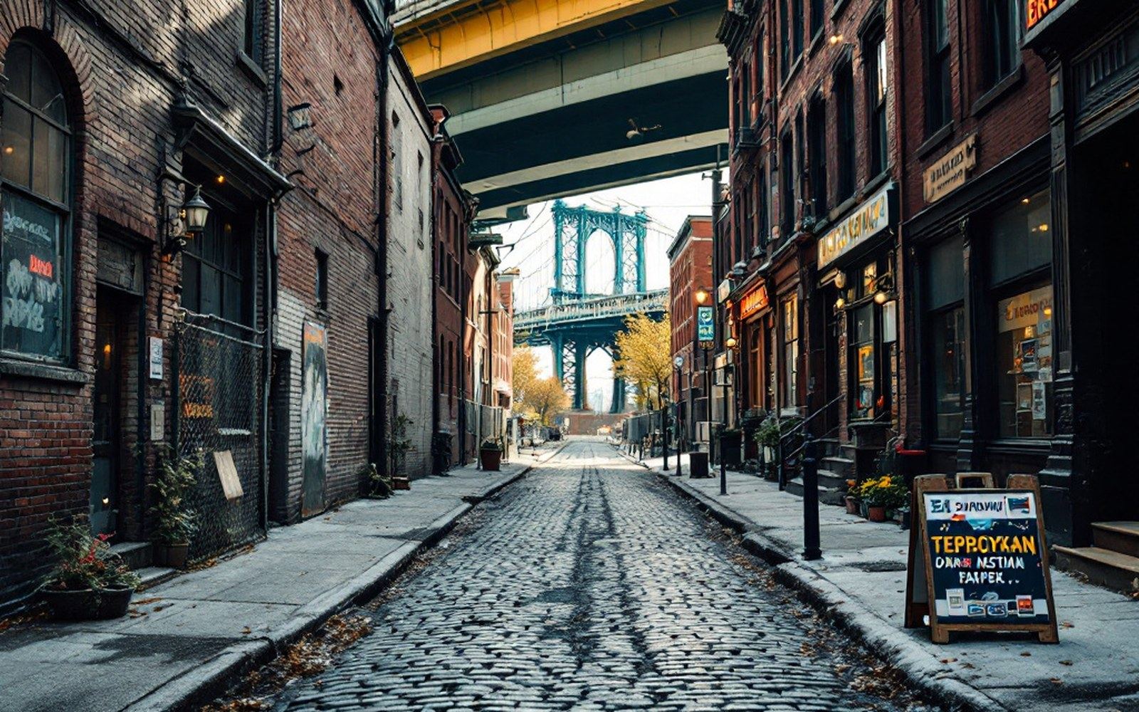
A street that simply stops: the expressway deck overhead is the reason the cobbles survived.
The Gowanus Expressway ran a wall of concrete above Third Avenue, and Red Hook never recovered — which is why it looks the way it does.
The cut
Robert Moses did not invent the idea of running freight traffic along the Brooklyn waterfront, but he perfected the damage. The Gowanus Expressway, elevated above Third Avenue and completed in 1941, formalized a boundary that is still legible today: on one side, the connected grid of South Brooklyn; on the other, Red Hook, increasingly unreachable by anything except a long detour around the structure's piers. The Brooklyn-Queens Expressway — the BQE — extended and deepened the separation when its own elevated section pushed through in the late 1950s, completing what planners had drawn as a regional freight corridor and what residents experienced as a wall. Noise, shadow and diesel particulate settled over the neighborhoods beneath. The industrial waterfront, already under pressure from the containerization that was killing the break-bulk piers, had one more reason to empty out.
What the expressways accomplished, in urban terms, was a kind of accidental preservation. Real-estate pressure needs connectivity to convert old stock into new stock; without easy access, Red Hook was simply not worth the trouble of redevelopment. The result — visible now to anyone who walks the interior streets — is a nineteenth-century street pattern largely intact: low brick warehouses, two- and three-story workers' housing, cobblestoned blocks, the occasional cast-iron detail. Almost none of it was designated, landmarked or otherwise protected in any formal sense. It survived because it was inconvenient.
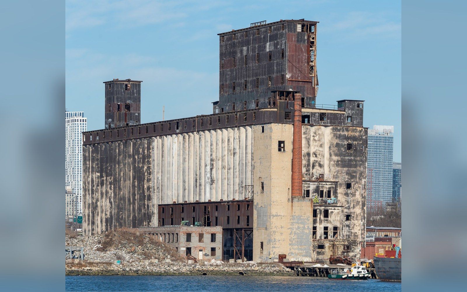
The grain terminal on the Erie Basin, empty for most of its working life.Red Hook grain terminal · Wikimedia Commons
What the grid remembers
Red Hook was laid out in the mid-nineteenth century to serve the port. The neighborhood takes its name from the Dutch Roode Hoek — red point, for the color of the clay soil at the peninsula's tip — and by the 1840s it held some of the busiest piers on the East Coast. Atlantic Basin, opened in 1847, was among the largest enclosed docks in the Western Hemisphere at the time, and the streets around it were built to move goods: wide enough for wagons, dense enough to pack in workers, connected at the waterfront end to the piers and at the inland end to the Gowanus Canal. The canal itself, dug between the 1840s and 1860s ↗, served as a working industrial waterway carrying lumber, coal, and manufactured goods — which is also why, by the twentieth century, it had become one of the most contaminated bodies of water in New York.
The workers who filled those streets came in waves. Irish immigrants arrived in the 1840s and 1850s, driven by the Famine, and shaped the neighborhood's early Catholic institutions. Italians followed in the late nineteenth and early twentieth centuries, concentrated in the blocks closest to the piers. Longshoremen, coopers, sugar refinery workers — the employment was physical and close, and the housing was built to match: small lots, narrow frontages, stoops opening directly onto the sidewalk. Brooklyn's brownstone belt, which ran through neighborhoods like Cobble Hill and Carroll Gardens just to the north and east, touched Red Hook only at its edges; here the vernacular was humbler, plainer brick and frame construction rather than the dressed brownstone of the more prosperous blocks.
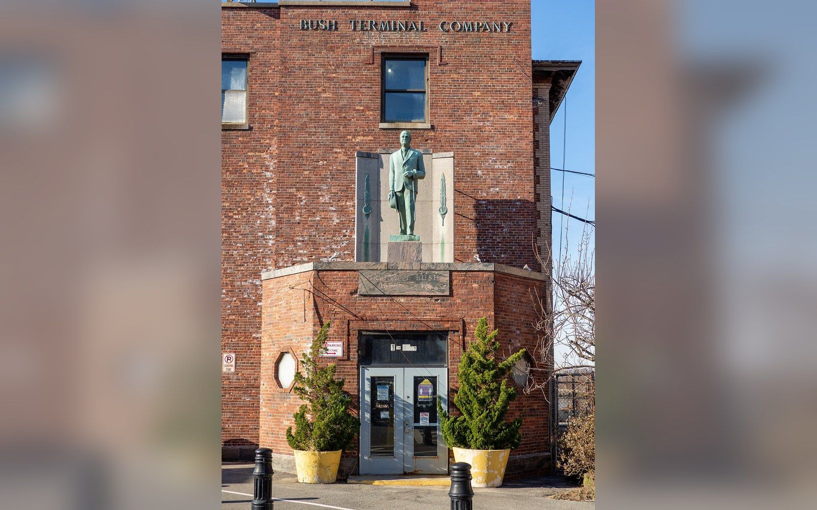
Two miles south, the same shoreline stayed in work.Bush Terminal Company · Wikimedia Commons
Chronology
1847Atlantic Basin opens, among the largest enclosed docks in the Western Hemisphere
1941Gowanus Expressway completed above Third Avenue
1938–1955Red Hook Houses built in two phases by the New York City Housing Authority
Late 1950sBQE elevated section completes the neighborhood's separation from South Brooklyn
1960sContainerization shifts port activity to Port Newark–Elizabeth; Brooklyn piers decline rapidly
What the streets show
Cobblestonesoriginal nineteenth-century street paving, surviving on several blocks because there was no impetus to replace it
Low brick vernacularworkers' housing built for longshoremen and refinery workers; plainer than the brownstone blocks to the north
Wide warehouse frontagesdesigned for wagon access; now subdivided into studios and small manufacturers
Atlantic Basinstill a working container terminal; visible evidence of continuity with the port economy
Containerization and the fall
The piers that had given Red Hook its reason for being began their long decline in the 1950s and 1960s, and the causes were structural rather than local. Containerization — the standardization of cargo into sealed steel boxes that could be transferred directly between ship, truck and rail — required deep-water berths, large flat staging areas, and crane infrastructure that the old break-bulk piers on the Brooklyn waterfront simply could not accommodate. Port Newark and Port Elizabeth, across the harbor in New Jersey, had the land; New York's containerization shifted westward across the harbor ↗ beginning in the early 1960s, and the Brooklyn piers shed employment rapidly. The longshoremen who had built the social fabric of Red Hook — the union halls, the social clubs, the dense webs of neighborhood obligation — found the work vanishing faster than the institutions.
What remained was a neighborhood that had lost its economic engine but retained its physical form. The warehouses along Van Brunt Street and the streets running to the waterfront stayed standing because demolition costs money, and because the land was not, in the absence of connectivity, attractive enough to redevelop. The Red Hook grain terminal, an enormous concrete structure visible from the harbor, became a symbol of this arrested condition: built for a trade that had already begun to move, it stood as the largest reinforced-concrete grain terminal in the world by some measures, and it has stood largely empty for decades. Its presence is a kind of monument to the exact moment when the infrastructure of one economy outlasted the economy itself.
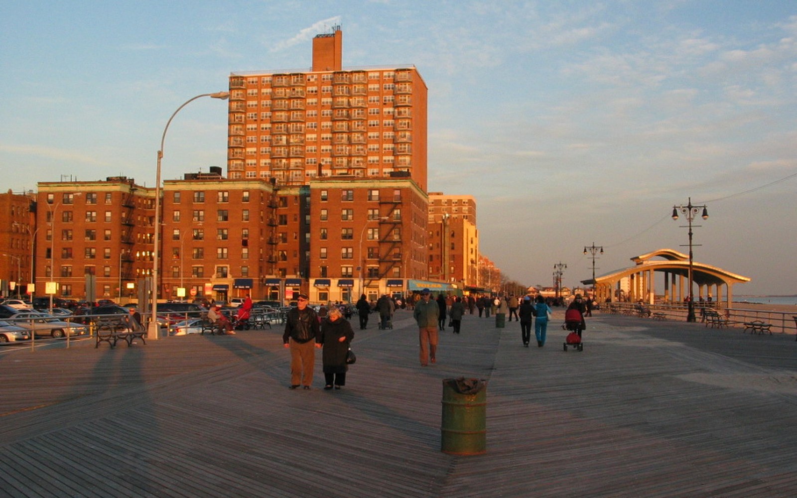
Water on three sides is the other half of the isolation.Brighton Beach, Riegelmann Boardwalk at Brighton 4th Street · Wikimedia Commons
Public housing compounded the isolation. The Red Hook Houses, built by the New York City Housing Authority in two phases between 1938 and 1955, added a residential population that was large, geographically contained, and poorly served by the transit connections available to the rest of Brooklyn. The subway does not reach Red Hook; the nearest stations are a walk away, across the BQE or around the Gowanus, and the buses that serve the neighborhood have long run infrequently. Isolation, in this case, was not intended — it was a byproduct of infrastructure built for other purposes.
What isolation preserved
The paradox is that the neighborhood most dramatically cut off by mid-century planning is now among the most visually coherent in Brooklyn. Walk the blocks between Van Brunt and Conover Streets and you are moving through a fabric that has not been significantly altered since the 1890s. The scale is consistent: nothing very tall, nothing built for automobiles at grade. The streets are narrow by outer-borough standards, the lots irregular, the buildings varied in the way that comes from incremental construction rather than comprehensive development. Several of the old warehouse interiors have been subdivided into working studios and small manufacturers — a continuity with the industrial past that is rare in neighborhoods that gentrified faster and more completely.
The landmarked Atlantic Basin ↗ remains a working container terminal today, operated by the Port Authority of New York and New Jersey, which means that Red Hook retains an active relationship with the port economy that made it — something that almost no other neighborhood on the Brooklyn waterfront can claim. Trucks still move through the neighborhood's streets. The grain terminal still dominates the view from the water. The cobblestones on some blocks are still the cobblestones laid when the streets were built.
None of this is because anyone planned to preserve it. The Gowanus Expressway and the BQE were built to move freight efficiently and they did, at the cost of severing a neighborhood from its borough. The isolation that resulted was damaging in ways that are still visible — in disinvestment, in transit poverty, in the long-term effects on the Red Hook Houses' residents. But that same isolation held the wrecking ball at a distance. The nineteenth-century city that Red Hook contains survived not because it was valued but because reaching it, for most of the last seventy years, was not worth the bother.